SOFTWARE · THE SPINE
Vale Platform
The processing core of the Vale system. Bring imagery from any source, ours or yours, and let AI distill your data into actionable insights. Built for scale.
Source-agnostic by design
If it produces imagery, the platform can analyze it.
Any format, any source. Batch or stream.
 RESOLVE
AI + Depth detect, classify, and count.
Density maps, trends, and exports.
Capabilities
From raw imagery to wildlife intelligence.
Detect and classify at scale
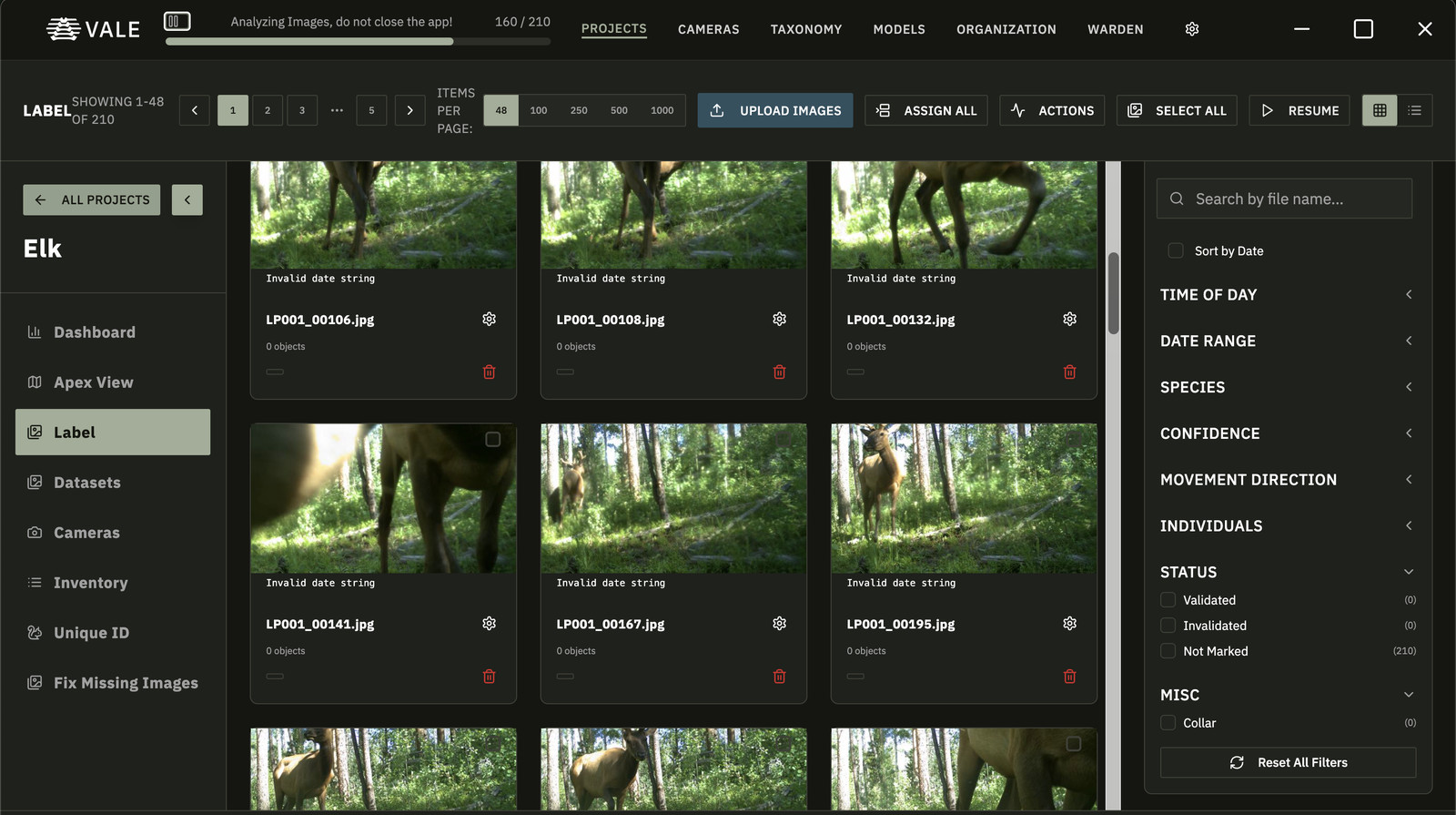
Process thousands of trail-camera images and full aerial survey datasets in one pass. Distributed GPU and CPU workers handle the volume, so you get results instead of a backlog.
Train models on your own data
Fine-tune detection and classification on your labeled imagery, improving accuracy for your species, your terrain, and your camera setups.
Full taxonomy with geofencing
Every detection carries complete taxonomic information, and region-specific constraints filter out species that do not belong in your area.
Distance and size from one image
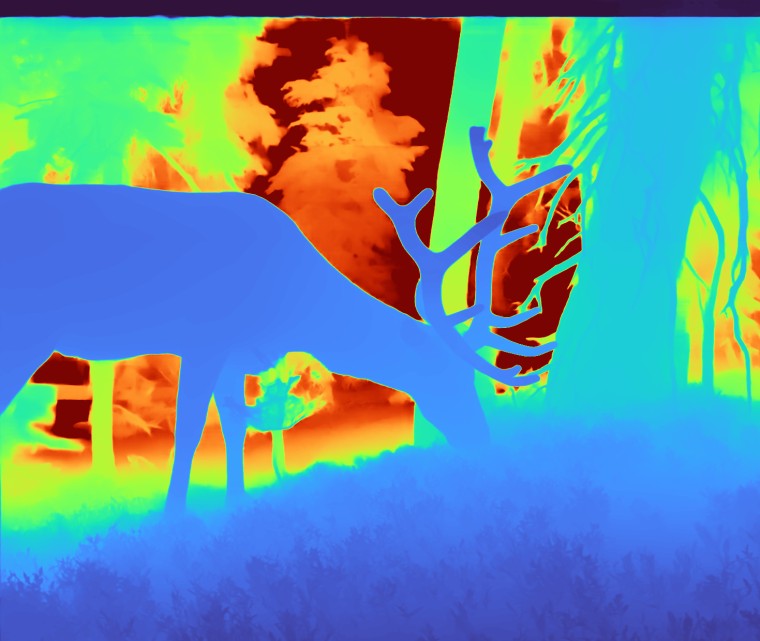
Depth estimation reads range and animal size from ordinary RGB photos, with LiDAR and RGB fusion when you need precise 3D localization.
Aerial surveys, no manual review
Large GeoTIFFs and aerial frames run through overlapping tile detection automatically. Cover wide regions and count what is there without page-by-page review.
Reports you can defend
Standardized CSV and PDF reports with detections, camera locations, study areas, and summary statistics, ready for stakeholders.
Ingest from anywhere
Pull from connected trail cameras, RTSP streams, S3 buckets, and direct uploads, organized by camera station and location on map views.
Inside the pipeline
How the platform reads one frame.
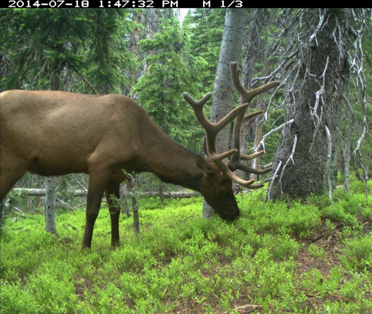
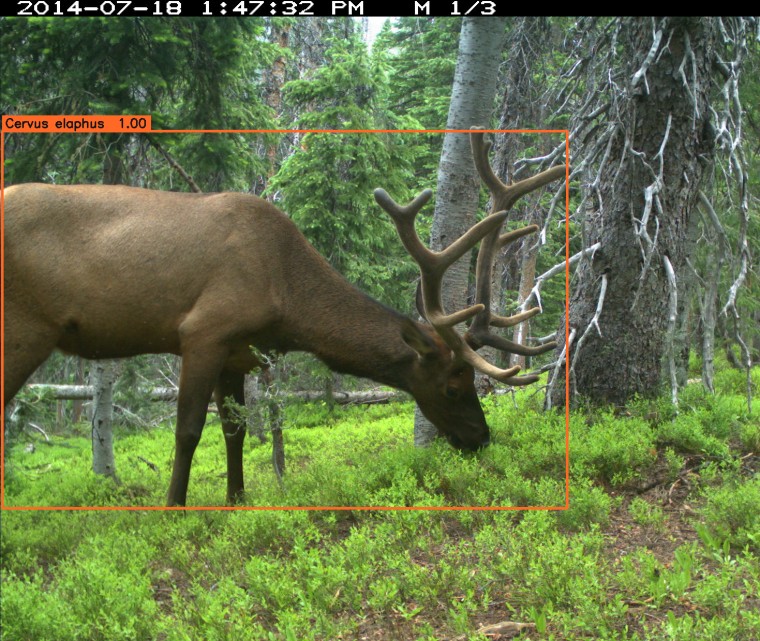
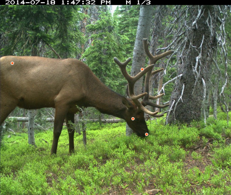
One trail-camera image, run end to end through the Animalis models. Detection finds the animal, classification places it in the full taxonomy, landmark detection maps its posture, and depth reads range and size, no second sensor required.
In the field
The platform in your pocket.
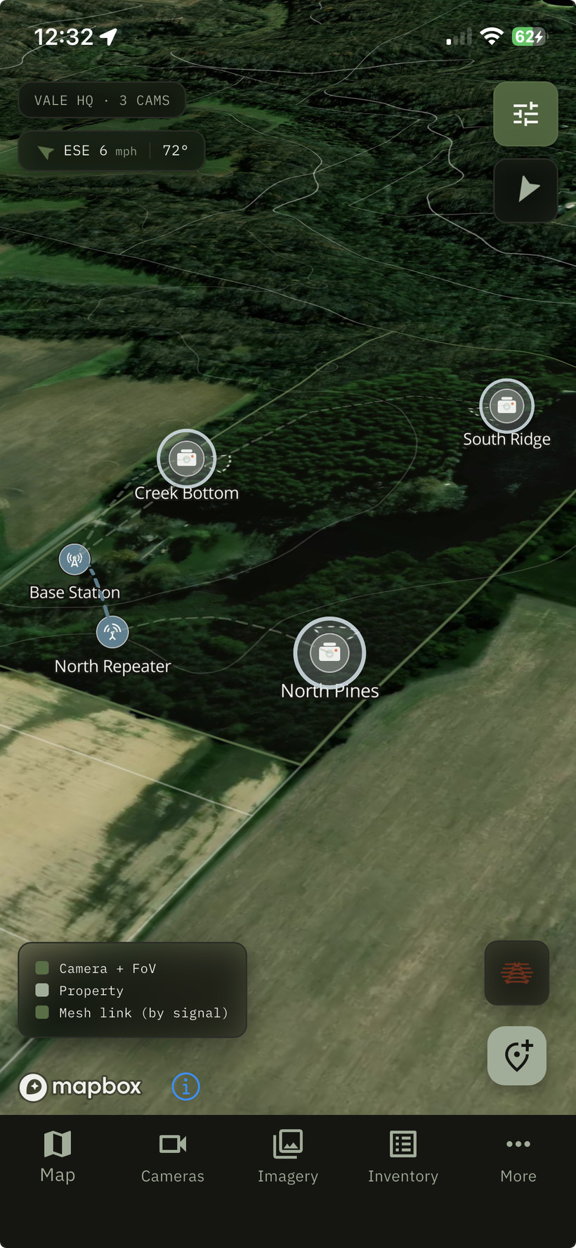
The Vale mobile app carries the same intelligence into the field, offline-first, with a live 3D map of every camera, detection, and trail on your property.
- 3D PROPERTY MAP A tactical satellite-and-terrain view with every camera and its field-of-view cone.
- LIVE TELEMETRY Battery, signal, and last-seen for every node, updated as they report in.
- INDIVIDUALS & INVENTORY Track named animals and build a season-long property inventory for large-property hunt management.
- SHARED WITH YOUR CREW Share maps, cameras, and inventory with everyone you hunt with.
- WAYPOINTS & TOOLS Drop stands, blinds, and feeders, measure distance and area, draw trails and fence lines.
- OFFLINE-FIRST Everything works without signal and syncs the moment you are back in range.
At a glance
Platform details
ROI calculator
What automated review saves you.
A trained technician reviews roughly 180 images an hour for species ID and counting; Vale processes about 0.2 seconds an image on a single GPU, around 18,000 an hour. Producing population-density estimates by hand can take about 15x longer per detection, which Vale also automates. Loaded labor rate based on US biological-technician wages.
Sources: iWildCam 2018; Norouzzadeh et al. 2018 (PNAS); Howe & Buckland 2017; Haucke et al. 2022. Methodology and references →